





Introduction
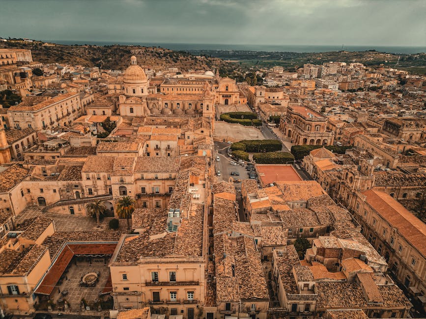
Sicily, a Mediterranean island with wildly varied landscapes — rugged coasts, golden-sand beaches, soaring volcanoes and ancient temples — draws thousands of travelers and photographers every year. For drone pilots it’s an incredible playground: vertiginous views from the slopes of Etna, aerial perspectives over the Valle dei Templi in Agrigento, flights above the white cliffs of the Scala dei Turchi, and marine scenes around Isola Bella in Taormina. But those stunning shots come with responsibilities: aerial photography is tightly regulated at both European and Italian levels, and Sicily is full of protected areas, archaeological sites and airports that impose flight restrictions or bans.
This article is written for you — recreational pilots and professional photographers planning safe, legal and creative flights in Sicily. I’ll walk you through the basics (registration, restrictions, authorized platforms), list well-known panoramic spots where flights are allowed — with exact addresses, opening times, prices and practical tips — and share photo and safety recommendations adapted to Sicilian terrain. You’ll also find suggested flight angles and itineraries to maximize the visual impact of your footage while respecting the law and flight ethics.
Before you take off, remember three simple principles: safety for people and property, respect for protected areas, and legal compliance. In Sicily that often means checking for local hazards (active volcanoes such as Etna), securing permits for national parks or archaeological sites, and adhering to airport proximity limits (Catania Fontanarossa, Palermo Falcone-Borsellino, Trapani Birgi). Proper preparation will save you disappointment, fines and possible confiscation of gear, and let you fully enjoy the island’s unique aerial perspectives.
The rest of this article will guide you step by step: from general regulations to must-see spots (with coordinates and fees), through technical photo tips (settings, composition, weather) and recommended routes. At the end you’ll have a practical checklist for each flight. Whether you’re shooting for a professional project or to build your personal portfolio, the goal is the same: capture Sicily with respect and responsibility.
Drone rules in Sicily: laws, procedures and useful platforms
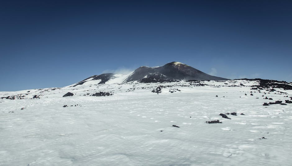
Legally, Italian rules follow the European framework (EASA regulation) but are supplemented by national provisions managed by ENAC (Ente Nazionale per l’Aviazione Civile). Here are the essential points to check before every flight in Sicily:
- Registration and identification: any drone over 250 g or any drone equipped with an image-recording system must be registered and the operator registered on the European Union portal for UAS operators. In Italy, it’s also recommended to sign up on the national D-Flight platform for flights in populated areas or near critical infrastructure.
- Flight categories: European rules distinguish the OPEN categories (A1/A2/A3) for non-certified flights and the SPECIFIC category for higher-risk operations. In Sicily, most tourist flights will fall into OPEN A2 (VLOS near people) or SPECIFIC if you fly close to sites that attract crowds or classified heritage locations.
- Pilot skills: a remote pilot must hold the required certificates: online training for OPEN A1/A3, an online exam for OPEN A2. For the SPECIFIC category, a risk assessment (SORA) or a national exemption may be required.
- No-fly zones and local restrictions: in Sicily watch out for NO-FLY areas: airports (Catania Fontanarossa — Aeroporto Vincenzo Bellini di Catania, address: Via Fontanarossa, 95121 Catania CT; Palermo Falcone e Borsellino — Via Enrico La Loggia, 90145 Punta Raisi PA), as well as certain nature parks and reserves (Riserva Naturale Orientata dello Zingaro, Riserva Naturale Orientata Oasi Faunistica di Vendicari). Major archaeological sites (Valle dei Templi, Parco Archeologico di Selinunte) often require a prior written authorization from the Soprintendenza ai Beni Culturali.
- Permit requests: for SPECIFIC category flights or flights over protected sites, contact the Soprintendenza regionale per i beni culturali e paesaggistici of the Sicily region or the local park authorities. Be ready to submit a flight plan, proof of liability insurance, and technical details of your drone. Processing times can range from a few days to two weeks depending on the sensitivity of the site.
- Privacy rules: Italian law protects privacy; avoid filming people without consent, especially in urban areas, markets or crowded beaches. Fines can be issued if an image violates privacy or personal integrity.
- Insurance: taking out specific drone liability insurance is highly recommended — some sites require it before granting flight permission. Approximate prices: €30–€200 per year depending on coverage and equipment value.
Practical tip: before every flight check the national U-Space map (D-Flight) for temporary restriction zones, local NOTAMs and events (festivals, security operations) that could ban flying. Always carry digital copies of permits and certificates: the polizia municipale or carabinieri may ask for proof of compliance at any time.
Authorized panoramic spots and exact coordinates
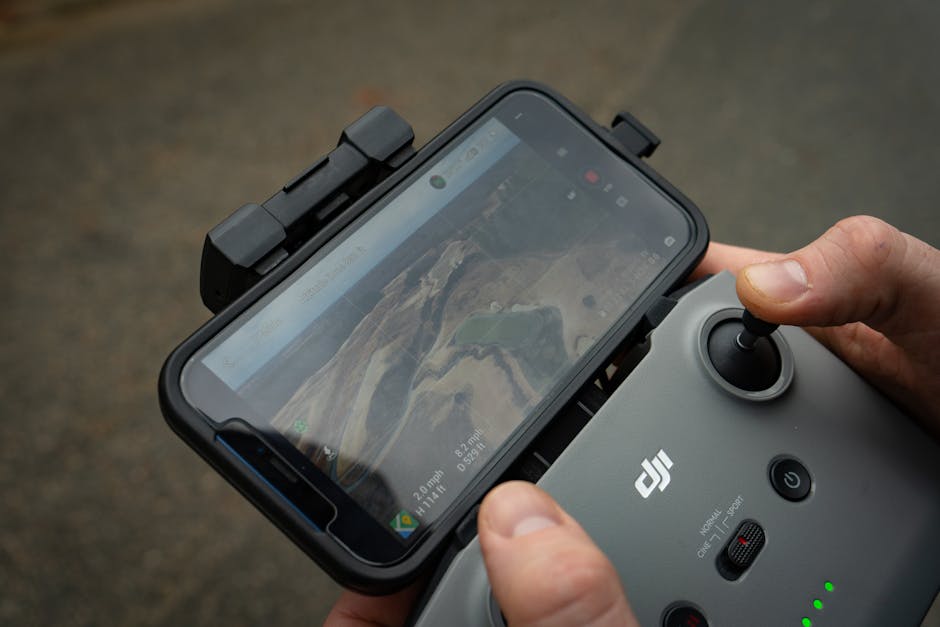
Sicily is full of photogenic spots; below are places where, while observing local regulations and obtaining permission if required, you can capture spectacular aerial images. For each spot: full name, address, opening hours, access price and on-site practical tips.
Valle dei Templi — Agrigento
Name: Parco Archeologico e Paesaggistico della Valle dei Templi (Valle dei Templi)
Address: Via Panoramica Valle dei Templi, 92100 Agrigento AG
Opening hours: generally open daily; hours vary by season — in summer 09:00–19:00, in winter 09:00–17:00. Check the official site before visiting.
Price: adult ticket around €12 (discounts for youth, seniors and groups). Full-route pricing may vary with temporary exhibitions.
Description: The Valle dei Templi is an extensive complex of Doric-Ionic temples dominated by the Temple of Concordia, with views stretching to the sea. Aerial shots reveal the geometric layout of the ruins and the contrast between ochre stone and Mediterranean scrub. Overflights are strictly regulated: the Soprintendenza ai Beni Culturali requires a formal authorization. Best shooting times are dawn and sunset for warm light and long shadows.
Teatro Antico di Taormina and Isola Bella
Name: Teatro Antico di Taormina (Ancient Theatre of Taormina) — Isola Bella Nature Reserve
Address: Teatro Greco, Via del Teatro Greco, 98039 Taormina ME / Isola Bella: Lungo Mare Giuseppe Galati, 98039 Taormina ME
Opening hours: Teatro Antico: generally open 09:00–19:00 (extended summer hours for performances). Isola Bella: access to the reserve depends on the tide; the small beach is accessible throughout the day but the protected area has regulated periods.
Price: Teatro Antico ticket about €10–€12; Isola Bella reserve: small entrance fee around €4–€6 (varies by season).
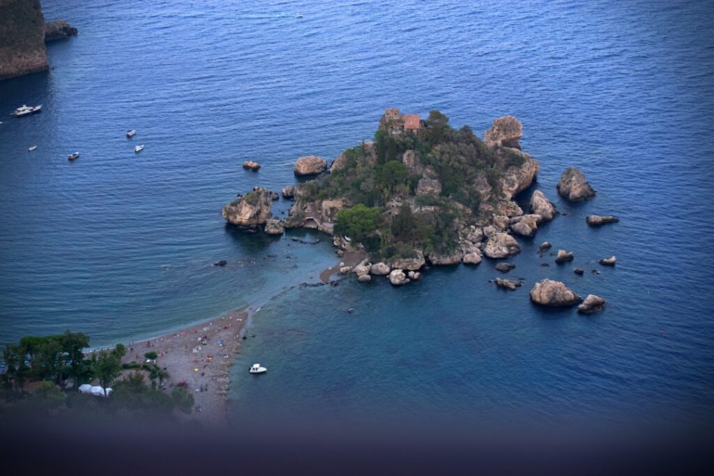
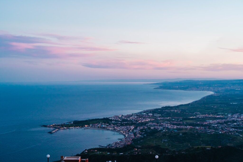
Description: The Teatro Antico offers panoramic views over Taormina bay with Etna as a backdrop. Flying from a controlled angle (and with authorization) you’ll capture the theatre’s geometry and the coastline. Isola Bella, a small rocky island connected by a sand spit, makes perfect sea-land transition compositions. Flights above crowded beaches are forbidden without a permit — prefer early morning or late afternoon to avoid crowds and stay legal.
Etna South — Rifugio Sapienza (Nicolosi)
Name: Etna South — Rifugio Sapienza / Funivia dell’Etna
Address: Strada Provinciale 92 km 7, 95030 Nicolosi CT (Rifugio Sapienza)
Opening hours: Road access to Rifugio Sapienza year-round depending on weather; funivia (if operating): hours vary, typically 09:00–17:00 in high season. Check the funivia and mountain guide availability.
Price: parking by car is free; paid activities include guided 4×4 excursions, funivia and guided tours — about €40–€120 depending on the package. Drone flights on Etna are sensitive: safety zones around active craters require authorization from Protezione Civile and ENAC.
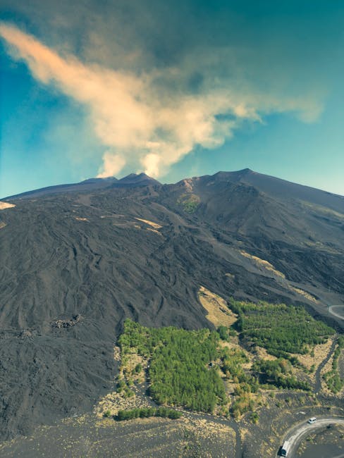
Description: Etna is both spectacular and tightly regulated. Shots from slopes and panoramic viewpoints (Rifugio Sapienza) reveal the cone, lava flows and the lunar landscape around it. Wind and volcanic ash can damage electronics, and temporary exclusion zones are common. Contact Parco dell’Etna and Protezione Civile to get the operational guidelines for the day.
Scala dei Turchi — Realmonte
Name: Scala dei Turchi (Stair of the Turks)
Address: Spiaggia della Scala dei Turchi, 92010 Realmonte AG
Opening hours: Free beach access; conservation zones with regulated access: generally accessible from sunrise to sunset.
Price: beach access is free, nearby parking often paid (€3–€10 depending on season and service). Local rules may limit overflight due to geological fragility and crowds; check with Realmonte municipality.
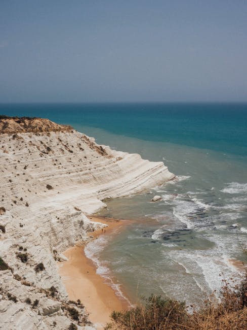
Description: The white marl cliff sculpted into natural « steps » overlooks turquoise water, creating a striking contrast. Aerial shots capture the texture of the strata and the geometry of the natural staircase. Respect no-fly zones and avoid flying over people. Golden hours bring warm tones to the white rock.
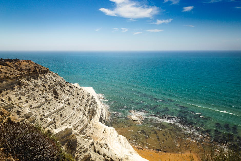
Photo tips, flight safety and local best practices
Shooting Sicily with a drone demands as much technical prep as regulatory awareness. Here are concrete tips to improve your images and fly safely:
- Weather prep: Sicilian weather can be unpredictable near coasts and in the mountains. Check aviation weather, Windy.com and local apps for wind, visibility and the risk of volcanic ash around Etna. Avoid flying in sustained winds above 30 km/h depending on your drone model.
- Camera settings: for GOLDEN HOUR captures: low ISO (100–200), shutter 1/1000–1/2000s if recording in 4K to retain sharpness, or adjust shutter for panoramic stills (use HDR bracketing if needed). Shoot RAW for post-production. For Etna and high-contrast scenes, plan bracketing to preserve highlights.
- Composition: use the rule of thirds and natural leading lines (cliffs, scenic roads, rows of olive trees). Oblique angles of 30–45° are often more immersive than strictly nadir shots. For temples and theaters capture both the architecture and its landscape context.
- Flight safety: check propeller condition, battery health (mountain flights reduce autonomy), and recalibrate the compass after each move. Stay out of densely populated areas and always maintain visual line of sight.
- Respect wildlife and locals: avoid flying over birds, herds or farm areas; don’t disturb residents and always ask permission before filming private properties or local events.
- Plan B: have alternate landing zones and download offline maps (Maps.me, Avenza); if possible, have a ground assistant to watch crowds and ensure safety.
- Recommended gear: a drone with a 1″ sensor or larger for better dynamic range, ND filters to manage exposure in bright sun, spare propellers, a powerbank, and a waterproof bag to protect electronics near beaches.
Sample 5-day itinerary to capture Sicily by drone (suggested shots)
Here’s a sample itinerary to get the most visually out of Sicily in five days, with suggested angles, best times and logistical notes:
- Day 1 — Taormina & Isola Bella: arrive early for dawn flights from the Teatro Antico viewpoint (Via del Teatro Greco, 98039 Taormina ME). Morning is ideal for capturing the bay and Isola Bella from an oblique angle, then descend to Lungo Mare Giuseppe Galati for low sea-level shots. Parking: Parcheggio Porta Catania, Via Nazionale, rates around €1–€2/hour. Tip: avoid theater performance times.
- Day 2 — Etna South (Rifugio Sapienza): plan a clear morning; capture lava flows, craters and the winding road, but secure permissions if you plan to approach active craters. Parking at Rifugio Sapienza, Strada Provinciale 92, 95030 Nicolosi CT. Bring masks and a waterproof cover to protect from ash.
- Day 3 — Catania coastline & Cyclops Riviera: shoot along the Riviera dei Ciclopi (Aci Trezza, Via Lungomare) to juxtapose volcanic rocks and fishing villages. Start point: Piazza S. Giovanni, 95021 Aci Trezza CT. Free access. Perfect spot at sunset.
- Day 4 — Valle dei Templi (Agrigento): book a permit ahead for a controlled flight over the park. Launch from an authorized peripheral area to capture the temple line at sunset. Parking: parking Valle dei Templi, Via Panoramica, 92100 Agrigento AG. Entrance ticket about €12.
- Day 5 — Scala dei Turchi & Selinunte: start early at Scala dei Turchi (Spiaggia della Scala dei Turchi, 92010 Realmonte AG) to avoid crowds; in the afternoon head to Parco Archeologico di Selinunte (Piazza della Vittoria, 1, 91022 Castelvetrano TP) to photograph temples and coastline from the sky after obtaining permission if needed (park ticket ~€7–€10).
For each day, re-check opening hours noted above, factor in parking fees (often €3–€10) and anticipate permit requests (Valle dei Templi, Etna craters, Parco Archeologico di Selinunte). In high season book accommodation in advance and plan flights for early morning or late afternoon for optimal light and lighter winds.
Conclusion
Shooting Sicily with a drone offers unique opportunities: aerial perspectives on ancient temples, light play over limestone cliffs, volcanic panoramas dominated by Etna, and marine compositions around picturesque islets. Yet creative freedom must go hand in hand with strict compliance and deep respect for sites, residents and nature. Practically that means registering if required, following EASA and ENAC rules, obtaining permits for protected sites (Soprintendenza, Parco dell’Etna, Riserva dello Zingaro, etc.), taking out liability insurance and checking D-Flight and NOTAMs before each takeoff.
Also adapt your gear and settings to local conditions: coastal winds, volcanic ash, and Mediterranean light. Golden hours (dawn/dusk) often provide the best visual conditions, while safety demands avoiding crowded beaches and flying over crowds. Good communication with local authorities (municipalities, tourist offices, park wardens) eases permit processes and can grant access to more convenient launch zones.
Finally, think about visual ethics: respect privacy by avoiding filming individuals without consent, preserve the integrity of ancient sites by honoring no-fly zones, and share your images responsibly (note locations and conditions, mention whether permission was secured) to raise awareness within the pilot community. By following these best practices you’ll get the most out of Sicily — its textures, colors and light — while protecting the cultural and natural treasures that make the island unique.
Safe flights and great shots — whether you’re an amateur pilot or a pro photographer, Sicily will reward careful planning, respect and caution with unforgettable compositions.